


COMPANY INFORMATION
PRODUCTS
MY ACCOUNT
UBD Gregory's
UBD Gregory's, Australia’s leading brand for 75 years of the mapping industry, is a name synonymous with maps, atlases, and guide books. The UBD Gregory's name represents trustworthy and comprehensive products with up-to-date and concise mapping information.
MAPS
Their extensive range of City, Touring, State and National maps are available in a range of styles and price points. The maps come in a variety of formats and as both standard paper and a tear proof and water resistant stock for durability.
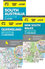
State maps
State maps from UBD Gregory’s printed on waterproof and tear-resistant synthetic paper, combining a map of the whole state, enlargements of the Capital region, plus street plans of several local towns.
The maps clearly show highways, major roads, route numbers and distinguish between sealed and unsealed other roads.
Symbols highlight visitor information centers, camping grounds and caravan parks, etc. Coloring indicates national parks or other protected areas and Aboriginal Lands.
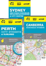
City maps
Double-sided maps from UBD Gregory’s, waterproof and tear-resistant, combining a very detailed street plan of the city and on the reverse, a map of the wider environs. A perfect choice for customers who need accurate and extensive mapping in a convenient size.
The maps show main road connections, highlights national parks and other protected areas. Symbols indicate locations of various facilities, city highlights, and places of interest.
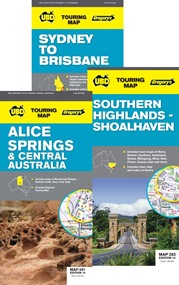
Touring Maps
A comprehensive series covering regional areas throughout Australia. Maps are packed with information for the traveller, including local tourist attractions (National parks and other protected areas), town facts, a local business guide and street plans of local towns.
The touring maps are double-sided, combining a touring map and enlargements highlighting various places of interest.
ATLASES
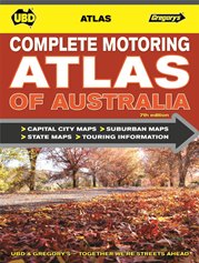
COMPLETE MOTORING ATLAS OF AUSTRALIA
- Spiral-bound for easy, in-car referencing
- The perfect companion while driving around this diverse country
- An invaluable planning guide with useful travel information
- Detailed mapping for all capital cities, states and territories
- Town centre maps with visitor information contact details
- Comprehensive Australian route maps
- Detailed city and town centre maps
- Capital city and suburban maps
- State and territory maps
- National park charts showing facilities
- Outback motoring and trip preparation
- City, state and Australia-wide touring information
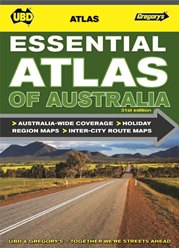
ESSENTIAL ATLAS OF AUSTRALIA
The Essential Atlas of Australia from UBD Gregory’s in an A4 paperback format, with coverage of individual state supplemented by more detailed mapping of the most visited holiday regions, a comprehensive distance table and diagrams of main intercity routes, etc.
- Detailed maps of holiday destinations
- Inter-city routes, city approach and bypass maps
- Text information on the best attractions in each capital city
- Color-coded, Australia-wide mapping
- Over 140 maps
- Capital city and suburban maps
- Maps of major provincial cities
- Regional holiday maps
- Comprehensive index with over 16 000 entries
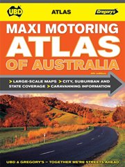
MAXI MOTORING ATLAS OF AUSTRALIA
- Easy-to-use, large-scale maps
- Detailed mapping for all capital cities, states and territories
- Comprehensive Australian route maps
- Detailed capital city maps
- Suburban maps
- State and territory maps
- National park charts showing facilities
- Exploring Australia by caravan
- Comprehensive index
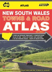
NEW SOUTH WALES TOWNS AND ROAD ATLAS
- Australia’s best-known and trusted road directory for New South Wales
- Produced in conjunction with Land and Property Information (Finance and Services), New South Wales
- Detailed and easy-to-follow maps
- 406 town maps (for every town with a population of 400 or more) arranged alphabetically
- The most complete state-wide mapping available (149 maps, all with geographic co-ordinates)
- Detailed mapping for Sydney and all major urban areas
- Over 38 000 index entries
- Full listing of community and emergency services
- Section on touring New South Wales
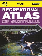
RECREATIONAL ATLAS OF AUSTRALIA
- Spiral-bound and medium format for easy handling
- Detailed mapping for all capital cities, states and territories
- Perfect for planning recreational activities around Australia
- Easy-to-use, large-scale maps
- 58 pages of information on a range of recreational activities
- Icons locating all top destinations for recreational activities on the maps
- Colour photographs
- Comprehensive index
ROAD ATLAS OF AUSTRALIA
- Spiral-bound and medium format for easy handling
- Detailed mapping for all capital cities, major tourist regions, states and territories
- Comprehensive Australian route maps and distance charts
- Comprehensive maps for 48 touring regions
- Useful touring information and lists of major attractions for all capital cities and touring regions
- Extensive distance charts
- National park charts showing facilities
- Over 140 colour photographs
- Comprehensive index
TOURING ATLAS OF AUSTRALIA
- The best atlas at the best price!
- Detailed mapping for all capital cities, states and territories
- Comprehensive Australian inter-city route maps
- Easy-to-use, large-scale maps
- Inter-city route maps with detailed town descriptions, including visitor centre details and nearby attractions
- Over 1000 recommended rest areas located along Australia’s major highways, broken into the following categories:
- Camp area, fee applies
- Rest area with free camping
- Rest area only
- Camp area with toilet, fee applies
- Rest area with free camping and toilet
- Rest area only with toilet
NEW ZEALAND TOURING ATLAS
- Large-scale maps
- City, suburban and state coverage
- Clear, easy-to-read mapping
- Detailed capital city maps
- Suburban maps
- State coverage
- Top attractions
- National park charts
- Distance charts
- Comprehensive index