


COMPANY INFORMATION
PRODUCTS
MY ACCOUNT
ANWB
The Netherlands have an extensive network of marked bike and hike routes, including the LF long-distance cycle paths and the LAW long-distance walking paths. Numbered junctions on the road or path side combined with marked trails make the route easy to follow for the cyclist or hiker.
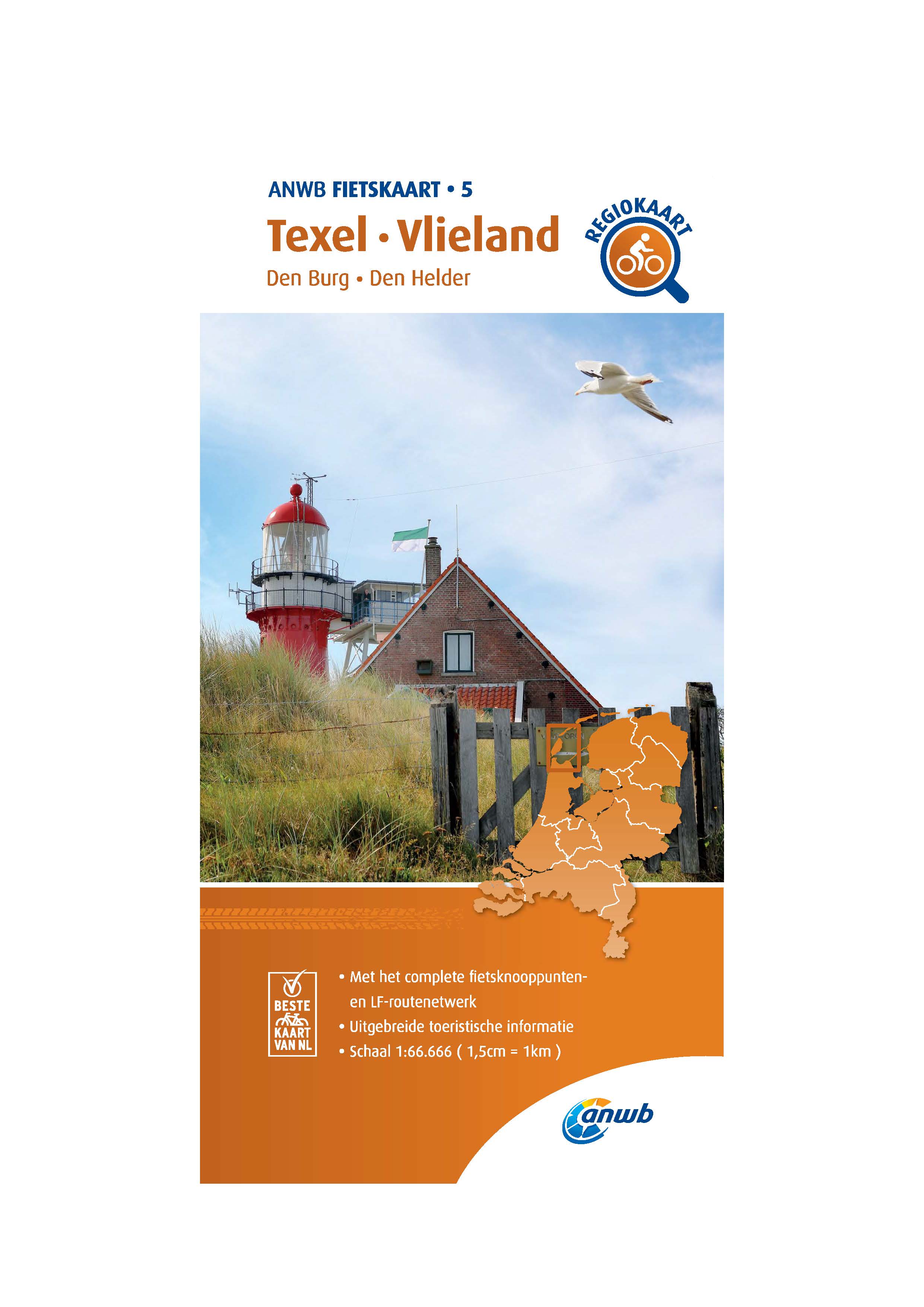
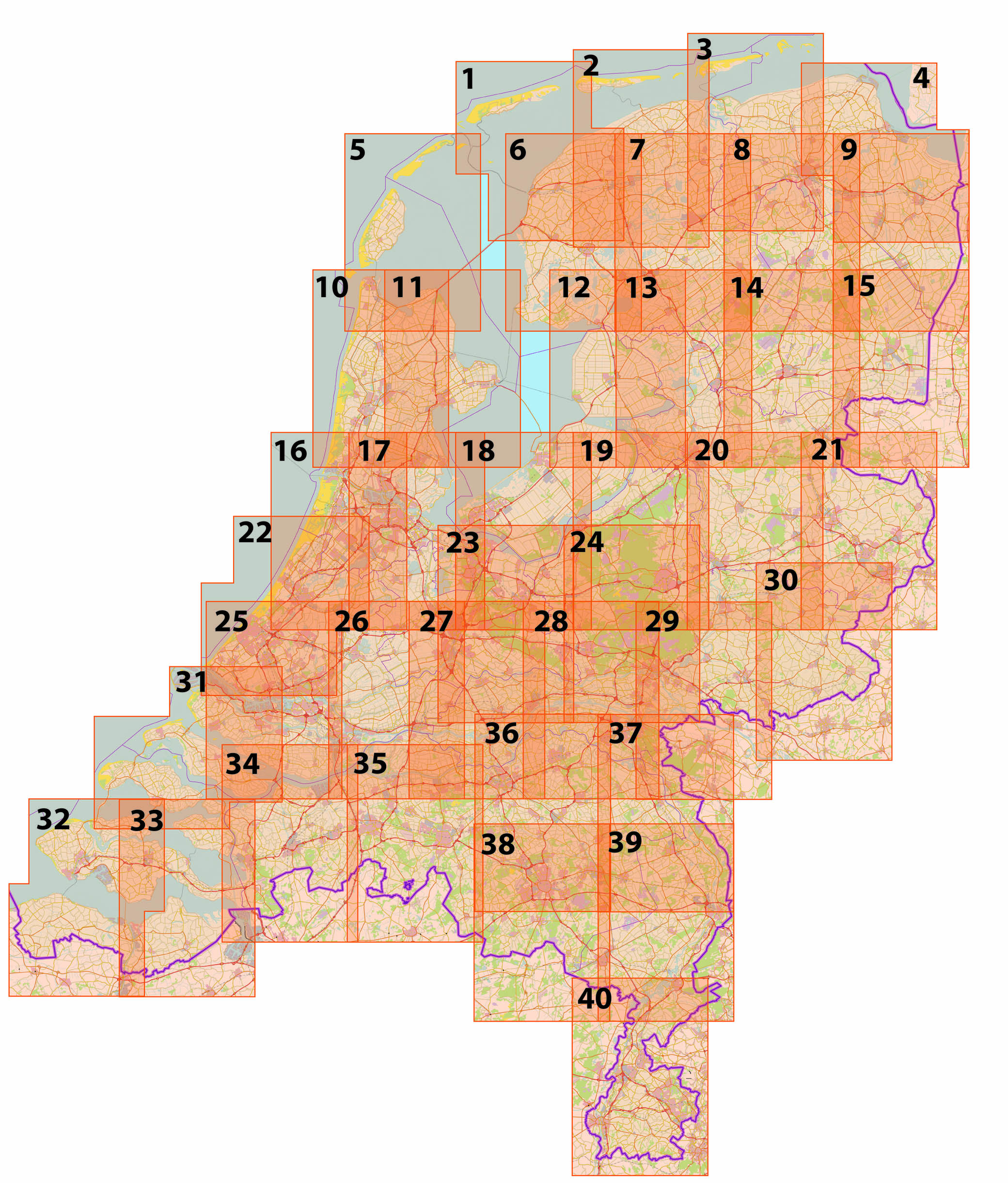
Region cycling maps of the Netherlands - scale 1:66.666
These foldable cycling maps are ideal for those who want more than just cycling on junctions. The paper route map contains many details: cycle paths, bicycle junctions, catering establishments, museums, campsites, ferries, LF routes (National Bicycle Routes), bicycle rental and tourist information.
The map functions as a handy route planner and has a scale of 1: 66.666. In total there are 40 ANWB Cycling Maps, from the Wadden to Maastricht and from The Hague to the Achterhoek.
Plan your cycling route through the Netherlands with clear ANWB Cycling Maps!
Craenen code: ANWB.FK.
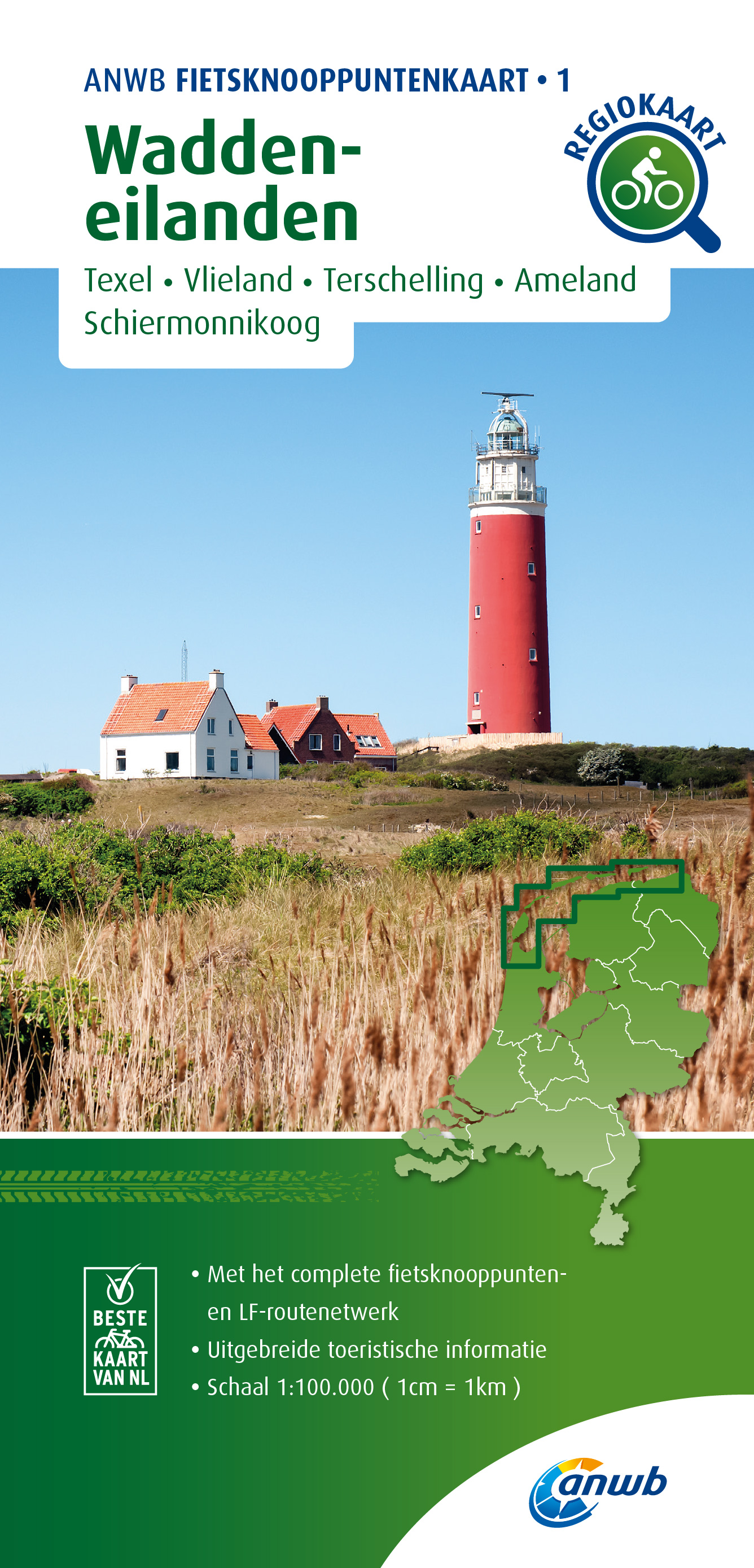
Cycle junction maps The Netherlands and part of Belgium - scale 1:100.000
Create your own cycling route with the ANWB bicycle junction map.
Enjoy the Dutch and Belgian landscape and plan a route through our National Parks, cycle along water and over dikes, through polders and meadow landscapes and take a break on a cozy terrace along the way. With the renewed junction map you choose your own cycling route. The map contains all LF routes (National Cycling Routes), tourist information, museums, catering and a clear legend. In total there are 28 ANWB Cycling Node Maps.
Craenen code: ANWB.FKN.
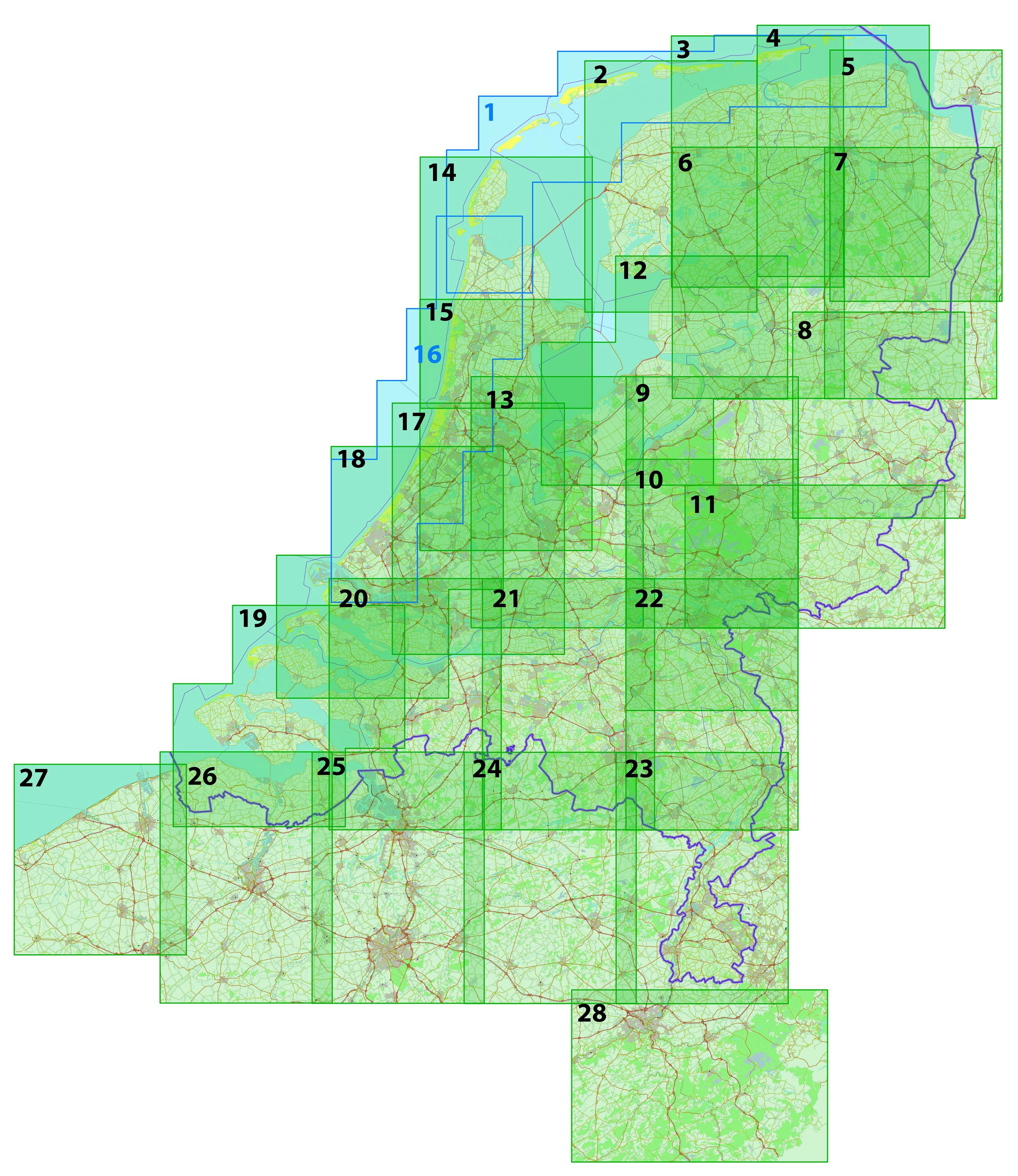
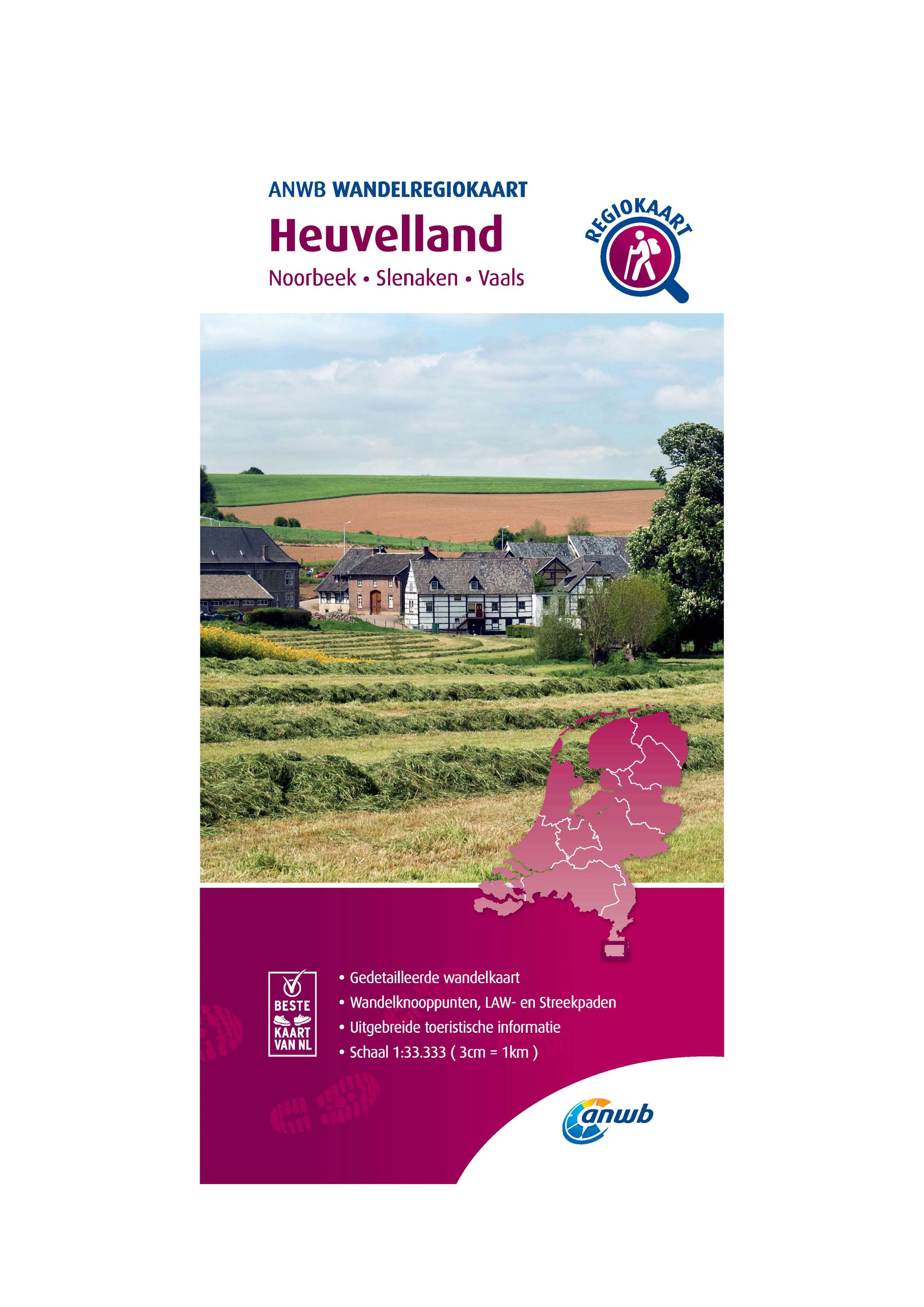
Region walking maps of the Netherlands - scale 1:33.333
Wonderful walking through the Dutch landscape, this new ANWB Walking Map is indispensable.
Plan your own route and discover our national parks, walk along water and over dikes, through polders and meadow landscapes and take a break on a cozy terrace along the way.
The all-new map image shows various national and regional hiking networks, LAW (Long-Distance Hiking Trails), regional trails and junctions. The routes are provided with boarding and parking places, catering, museums and tourist information. A total of 40 hiking region maps are available.
Craenen code: ANWB.WRK.

< Previous
Next >
< Back to overview maps