


COMPANY INFORMATION
PRODUCTS
MY ACCOUNT
Kümmerly+Frey
Nowadays this Swiss publisher is the most important player on the market in Switzerland for tourist maps. The Swiss cartographic quality guarantees a high level of accurate information. Craenen BVBA is the official distributor for Kümmerly+Frey in the Benelux and the UK.
The Kümmerly+Frey program contains:
- Hiking and excursion maps: ideal for walks and trips in your leisure time
- Bicycle maps of Switzerland
- Road maps, which contain every far flung corner of Europe
- Regional maps of Italy, France, Germany, Denmark, Great Britain, Norway and Sweden
- Road atlases: the new EuroAtlas with 50 000 place names & a road atlas of Switzerland with city plans
- Continent (with flags of the featured countries) and world maps
- Relief map in plastic of Switzerland in 3D.
A wide range of tourist maps with up-to-date and detailed information to plan your trip as easily as possible. These maps provide a quick overview of the travel route, and are reliable travelling companions, whether your travel by foot, bike, train or car.
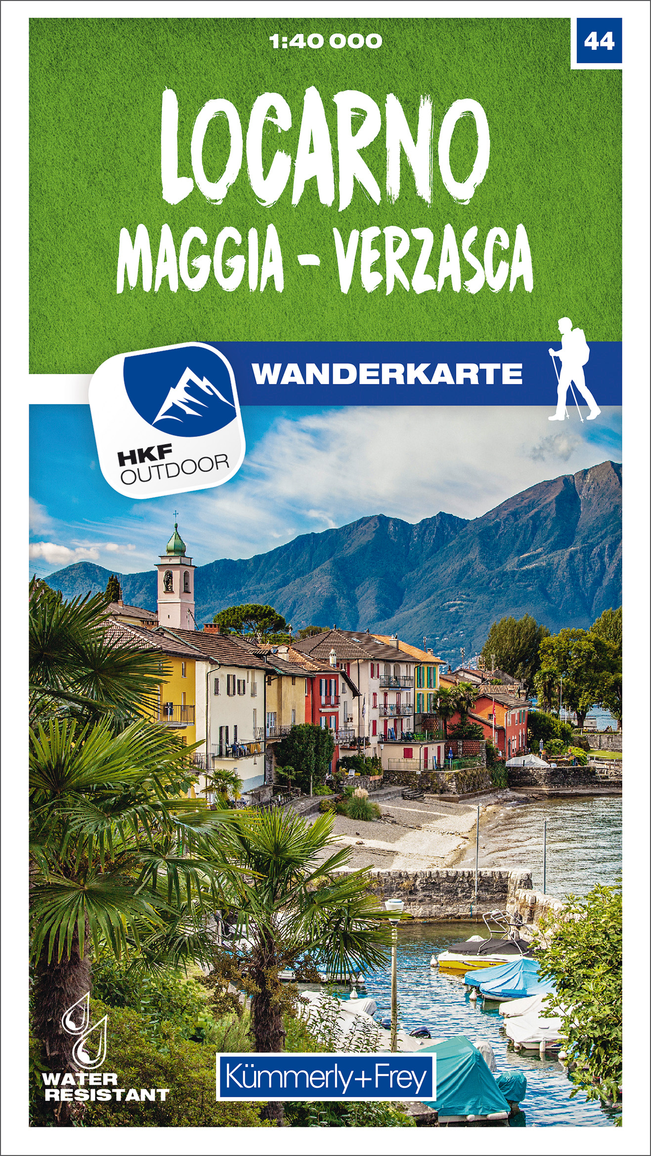
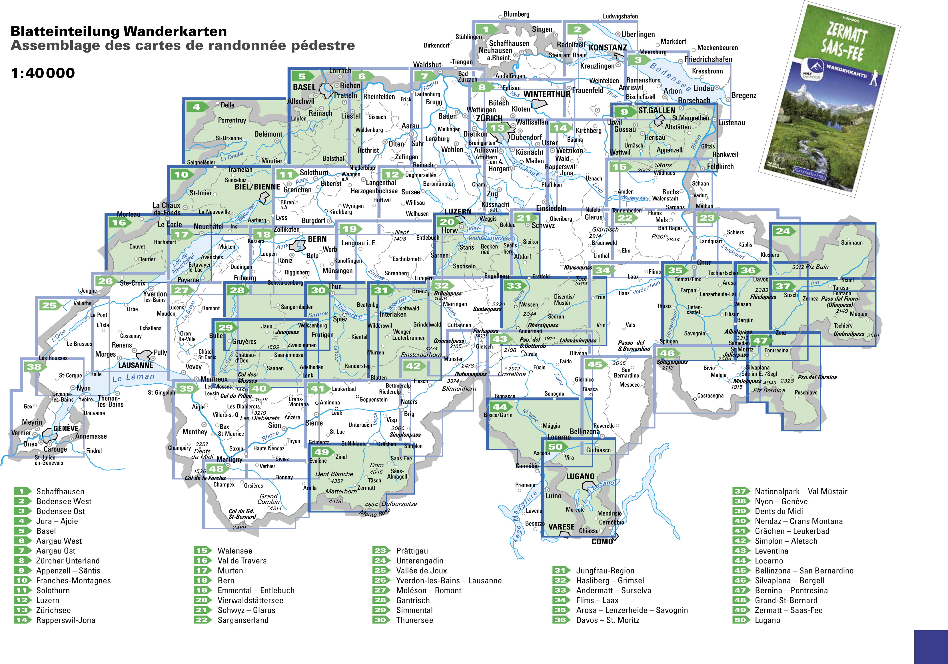
NEW HIKING MAP SERIE 1:40.000
Hiking maps at a scale of 1:40 000 for the whole of Switzerland.
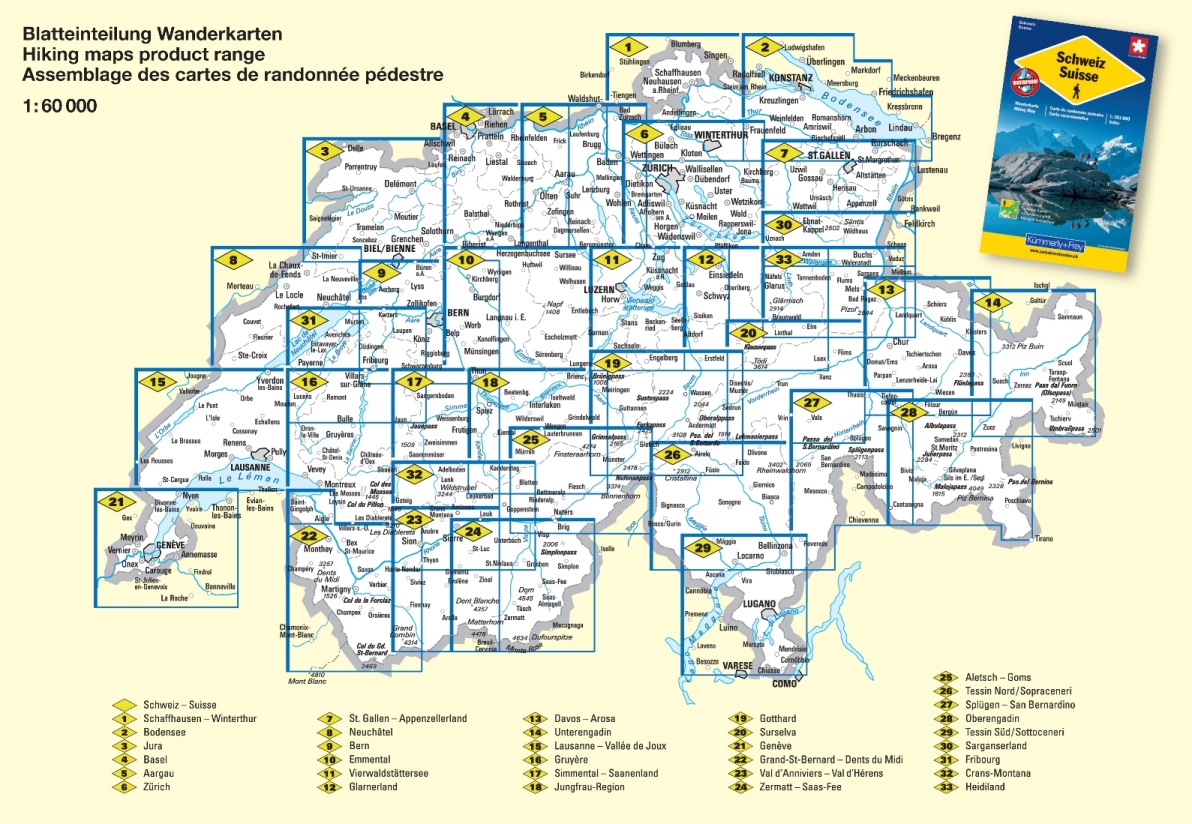
GRID INDEX:
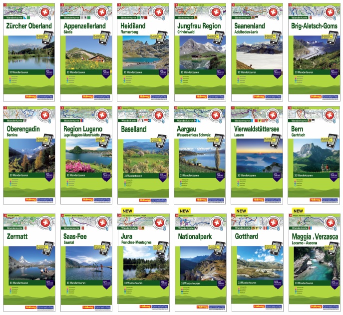
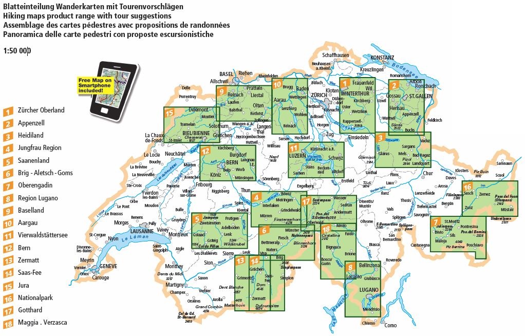
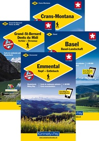
HIKING MAPS WITH TOURS
A new kind of product:
Map at a scale of 1:50 000 with 33 walking tours.
Map, guide and pictures – All in One.
These new hiking maps on waterproof and tear resistant paper present attractively suggested trips and give a quick overview of the planned tour. In cooperation with Geo-Tracks all important information about the most beautiful hiking regions of Switzerland has been incorporated in the maps:
Hight profiles, walking times, restaurants, public transport and much more!
On each paper map you will find a unique access-code to download the digital map for free on your smartphone.
GRID INDEX:
EXCURSION MAPS
Hiking in Switzerland
Kümmerly+Frey has created this series of hiking maps covering the whole of Switzerland in co-operation with cantonal and local walking path organizations. 32 sheets, most of them at the "ideal" 1:60 000 hiking map scale, guide you through Switzerland's most beautiful hiking and touring areas. Suggested walks are divided into the categories "walking path", "mountain path" and "alpine route". All maps feature useful additional information: accommodation, eating and drinking, bus-routes with stops, sports, leisure...etc
Maps with index and regional approach map, water- and rip-proof.
On each paper map you will find a unique access-code to download the digital map for free on your smartphone.
GRID INDEX:
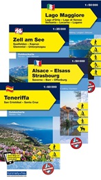
Excursion Maps International
Next to the Swiss excursion maps, Kümmerly+Frey publishes international excursion maps of Germany, Italy, Austria, Croatia, Spain/Portugal and France.
The map always shows for which sports the area is best: walking, cycling, Nordic walking, cross-country skiing, skiing or horse riding.
Click on the images to get a larger view.
GRID INDEX Germany: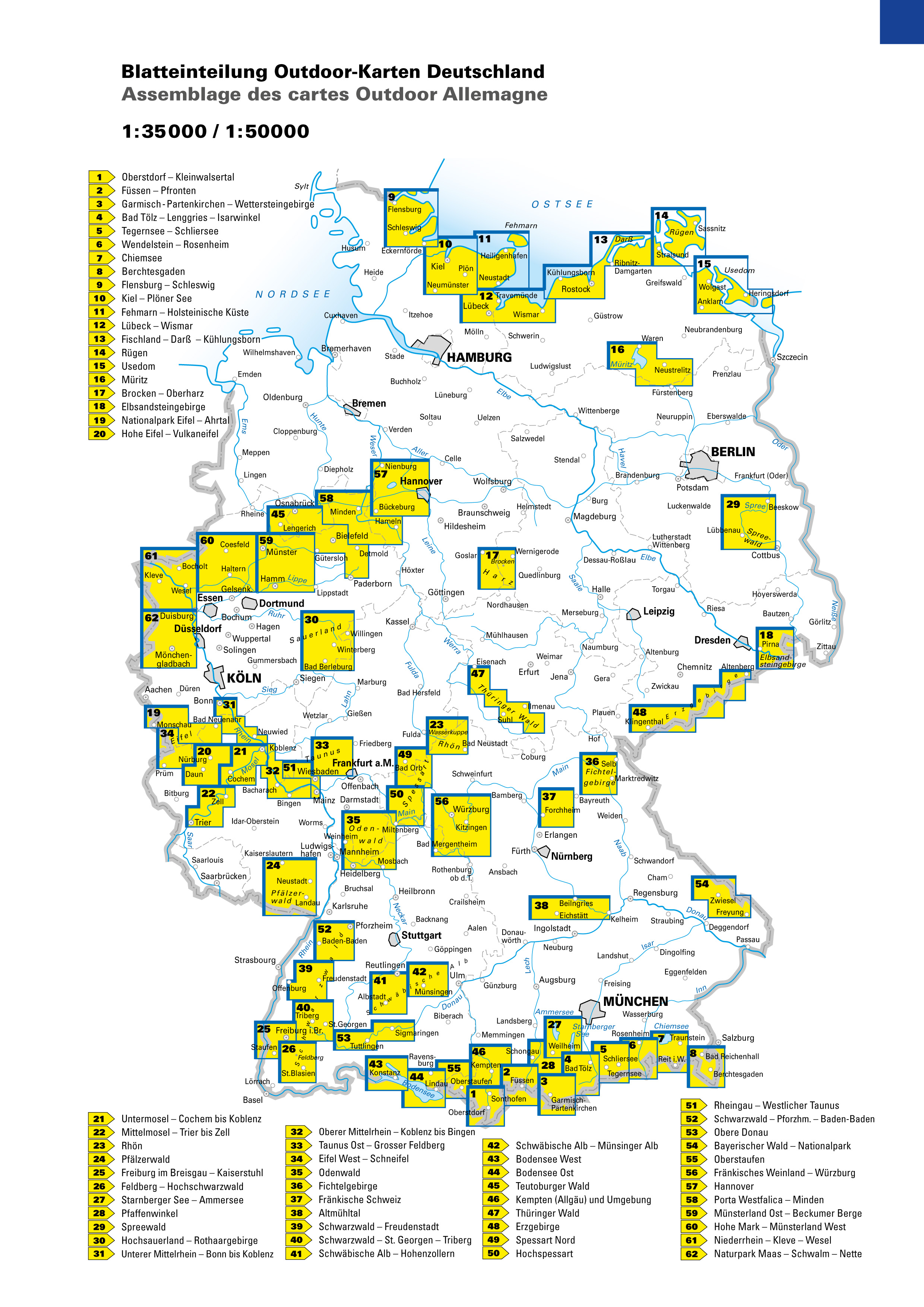
|
GRID INDEX Alsace & Vosges: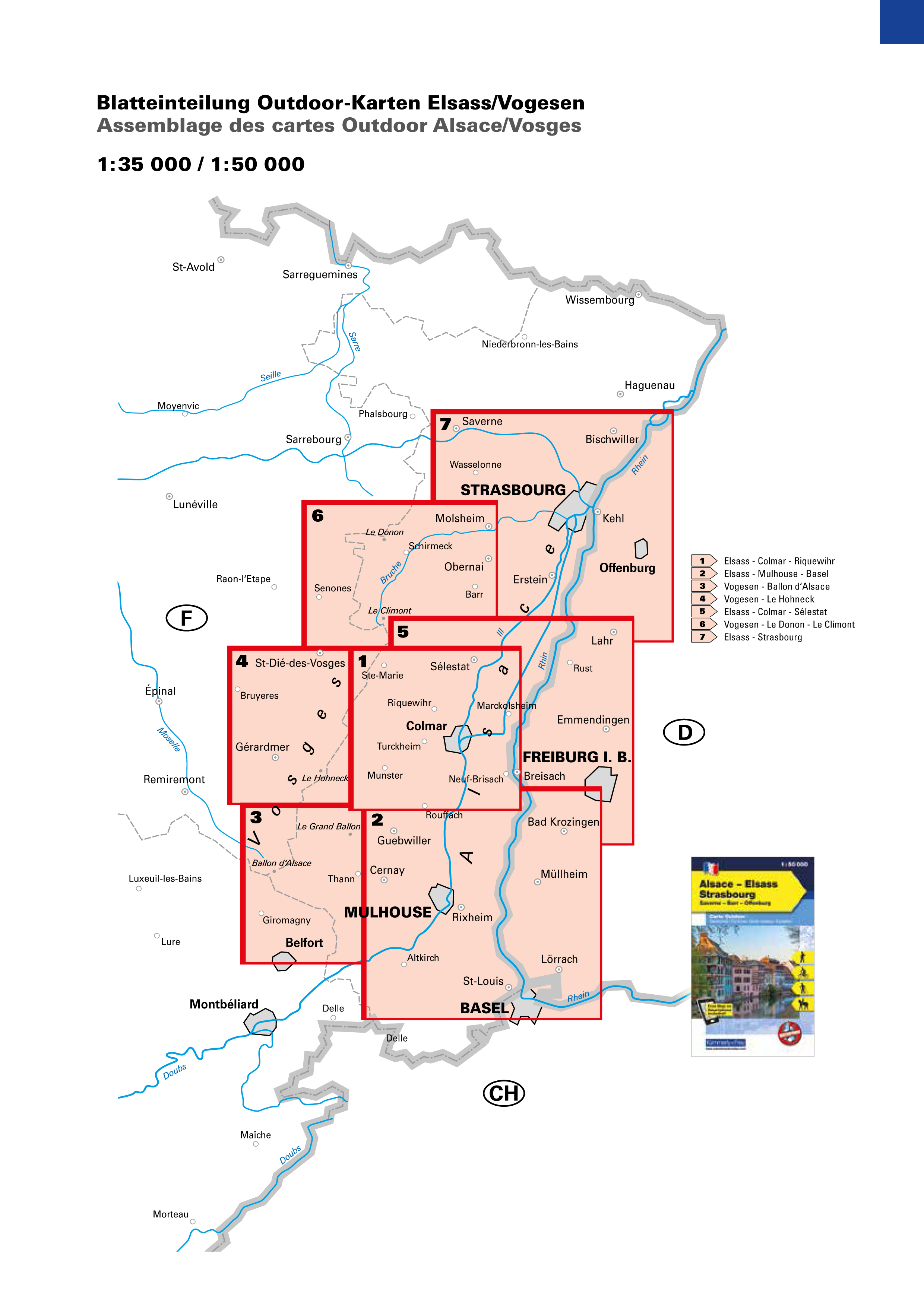
|
|---|---|
GRID INDEX Italy, Croatia, Spain & Portugal: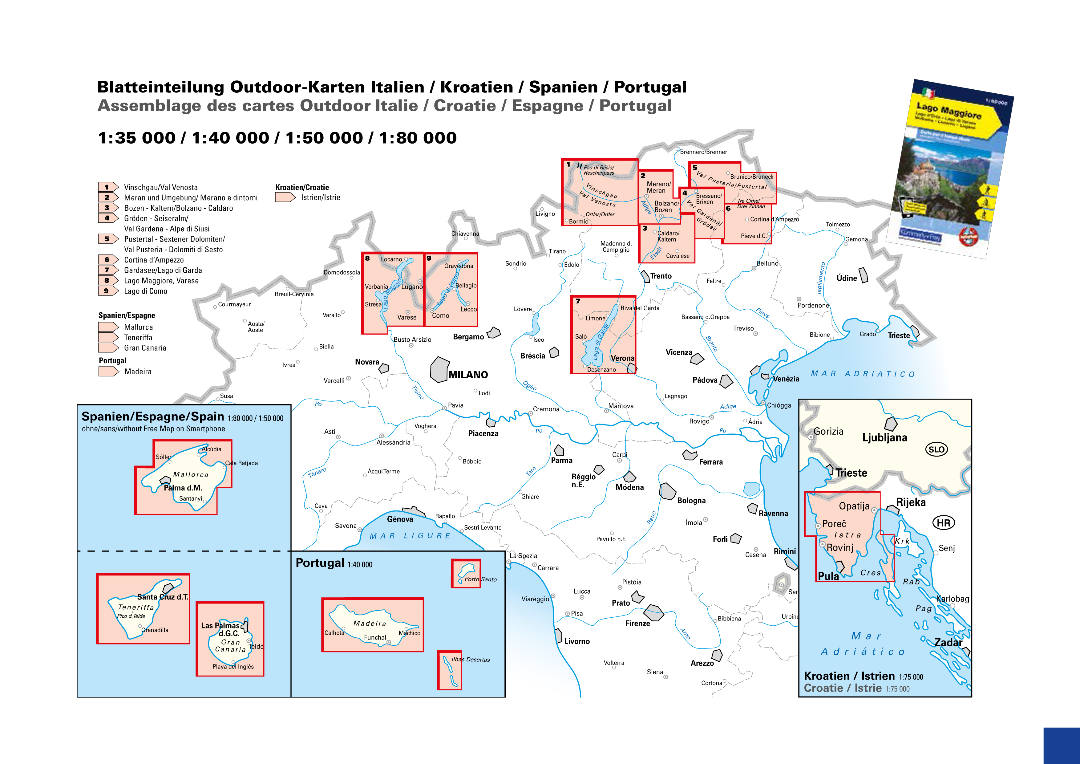
|
GRID INDEX Austria: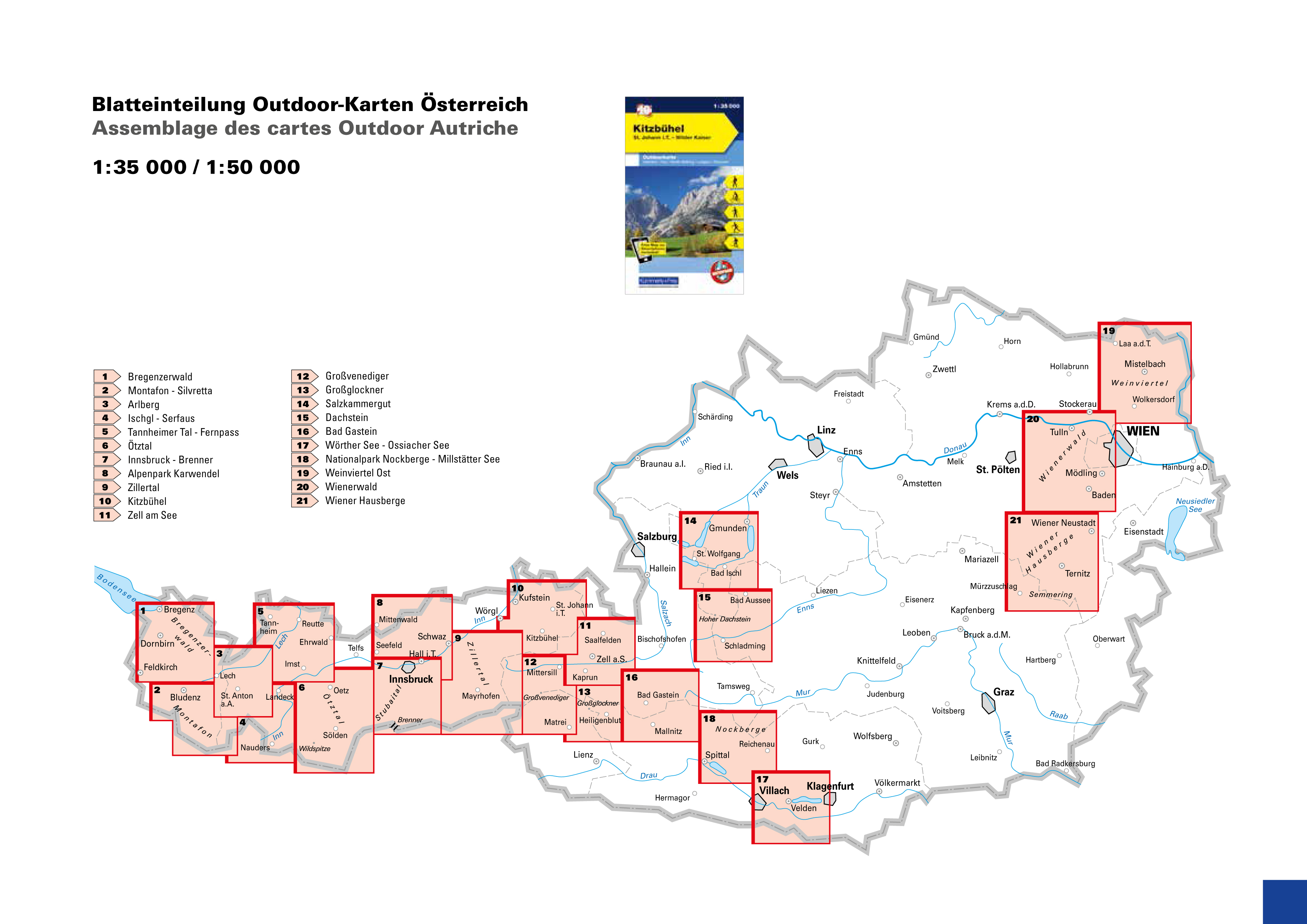
|
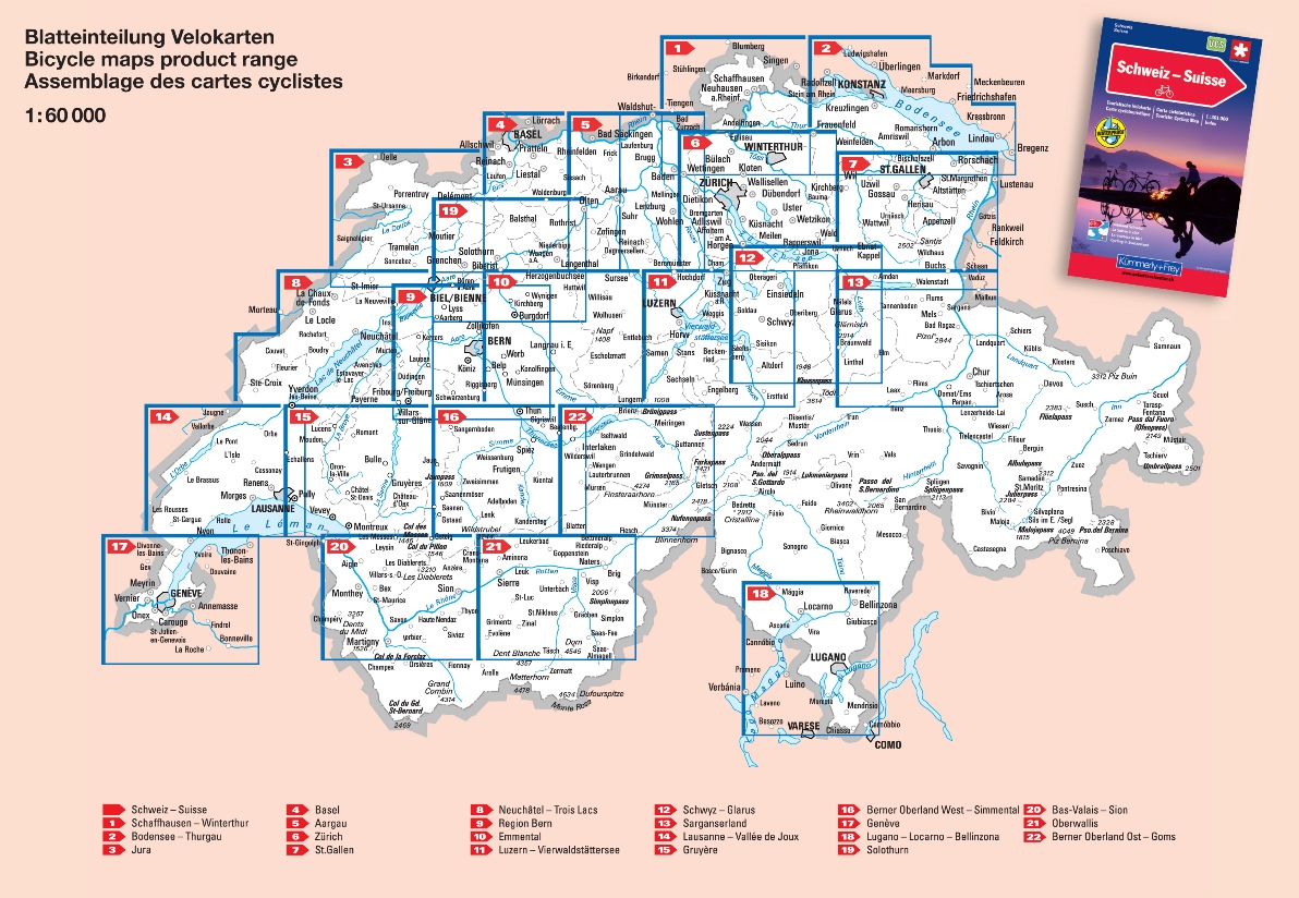
BICYCLE MAPS
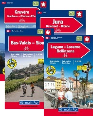
Cycling in Switzerland
Kümmerly+Frey has created this series of hiking maps covering the whole of Switzerland in co-operation with cantonal and local walking path organizations. 32 sheets, most of them at the "ideal" 1:60 000 hiking map scale, guide you through Switzerland's most beautiful hiking and touring areas. Suggested walks are divided into the categories "walking path", "mountain path" and "alpine route". All maps feature useful additional information: accommodation, eating and drinking, bus-routes with stops, sports, leisure...etc
Maps with index and regional approach map, water- and rip-proof.
On each paper map you will find a unique access-code to download the digital map for free on your smartphone.
GRID INDEX:
HIKING GUIDES / HOLIDAY MAPS
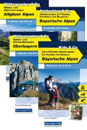
Switzerland: Wonderful world of hiking
For many leisure time equals time for walking, relaxing and enjoying barbecues. In line with current trends Kümmerly+Frey hiking books feature walks ranging from 2 to 5-hour-long. Thanks to this, families with children and older people can also take advantage of the suggested routes and get walking. Each book contains between 40 and 50 hiking routes with photographs, a small route map, an altitude profile, markings, a glance at possible weather conditions and the local geology. Completely in full colour.
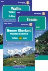
Holiday maps
Just get up and go. The Kümmerly+Frey holiday maps help you with your planning. And once you have arrived at your holiday destination they double up as silent tour guides: attractive map image, comprehensive regional coverage (a map for each holiday region), contents featuring interesting tourist information such as important walking paths, mountain huts and tourist attractions.